Development and validation of physically based advanced simulation models for water driven geophysical processes (SIMGEOWATER)
Universidad de Zaragoza, 2016-2018, Spanish Ministry of Science and Innovation (CGL2015-66114-R) (50% co-funded by FEDER)
Flash floods, avalanches, slope instabilities, levees or dam failure or avalanche induced waves in water bodies are examples of geophysical and hydrological-related phenomena which can cause great losses in infrastructure, property and human lives. Because of their own nature, the exact location of occurrence of these types of geophysical flows in space and time is highly unpredictable, and because of this, the study of areas and situations with potential risks aided by numerical simulation can help to design effective prevention strategies and structural solutions, especially in view of climate change in the near future. Numerical simulation is a unique and invaluable technology for the analysis, understanding and prevention of natural hazards.
But in order for computational tools to be useful in practical applications, great care must be taken in building accurate, efficient and robust numerical models. Furthermore, the complex situations that arise in natural geophysical flows, in particular, those generated by hydrological events, often require complex multi-physics models which are able to take into account phenomena of different nature, affecting different media although likely to occur simultaneously and actively affecting each other. One such case is that of hill-slope instability, initially due to rain, followed hill-slope infiltration, seepage and run-off (figure 1). The result is a hydrologically-triggered geophysical flow (HGF) with a complex mix of moving water, mud, debris, wet soil and dry granular materials. The study of the dynamics of such multi-material and multi-physical flows requires the understanding of the movement threshold of the soil masses, and its interaction with soil water-content as well as with erosion effects triggered by surface water. It also requires the quantification of the movement of water and soil masses once it has been initiated in terms the relevant physical variables (height, mass, extension, velocity, etc).
The study, modelling and prediction of these types of flow, of such varied nature, requires to explore in detail the dynamics of each of the components as well as the dynamics of the interaction between the components. It is, of course, essential to accurately model and simulate subsurface and surface water movement as well as granular flow dynamics, but it is also critical to accurately model the interaction between such processes. Current state of the art in numerical modelling of each of the submodels of interest, i.e., shallow water flows (SWF) including erodible beds (SWFE), subsurface water flow (SSF), dry granular flows (DGF) and wet granular flows (WGF) opens the door to envision an integrated and comprehensive multi-physics model encompassing and linking all of them. The Computational Hydraulics Group (GHC) based in the University of Zaragoza, in which this project is to be carried out is a leading research group in formulating, implementing and testing the submodels of interest.
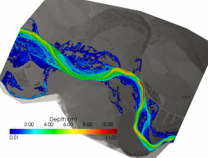
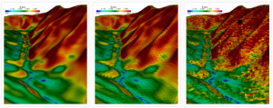
The GHC research group is one of the leading groups in shallow flow simulation. The SWF model that has been developed within the group is able to solve the shallow-water equations coupled with substance transport over complex irregular topographies and with wet/dry fronts, using robust mathematical methods (e.g., figure 2). Numerical simulation of sediment transport, erosion/deposition and movable bed problems has also been thoroughly studied and implemented. It has also been further extended to solve mud and debris flows. This technology has been thoroughly optimized for different space discretization techniques (e.g., figure 3) and expanded to account for various practical issues such as efficiency and available data.
This project aims at the development of high performance computational tools for the simulation of the hydrological and geomorphological processes of interest for flood prevention, at the level of the whole basin, with a special focus on urban areas. This represents a first attempt to combine all involved processes within a single framework trying to retain their physical basis. The main objective of this research project is the development of smart integrated hydro-geomorphological models able to simulate the complete system that, once validated and calibrated, can be the basis of reliable predictive tools ready to be combined with control algorithms. Models will be able to reproduce water levels, flow velocity, sediment transport and water quality in the context of high performance computing and will be completed by developing a mathematical framework to enhance realistic applications based on nature observations and experimental results.
The potential range of applications of such tools, capable of providing efficient forward solutions, is huge and does not exist so far because of the intrinsic complexity and the expertise it requires. Current commercial tools are not only expensive for general end-users but fail to take into account key processes related sediment transport and compromise spatial resolution to achieve computational speed. The proposed simulation tools will overcome these shortcomings by:
- New conceptual models for hydrodynamic and transport phenomena, using new empirical evidence from laboratory work.
- Implementing within a HPC paradigm, allowing for watershed-scale computations within affordable times for end-users with little resolution compromise.
Within this project, the group experience and knowledge will be used to achieve the goal of a coupled and unified simulation platform by:
- Strengthening the mathematical analysis of the models to ensure the robustness of the simulation tool;
- Developing fast-simulation algorithms for the numerical simulation of the different physical processes, based on existing models and taking advantage of GPU computing;
- Validating the new developments using existing well-documented test cases (lab and field data) and new experiments conducted within the project, especially designed for testing the new tools;
- Developing a unified, easy-to-use, modelling interface for the design of flood scenarios and GIS-visualization of the results.


